Alternative Names: Hause Point North
Type of Dive: Crummock water is a freshwater wall dive but usually very dark.
Suggested experience: Knowledge of altitude diving.
Travel directions: Google
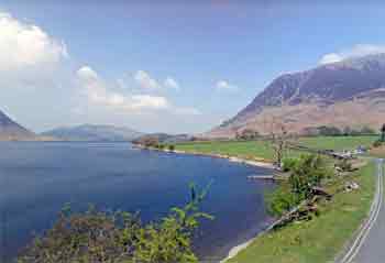
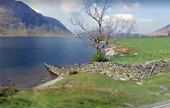
Parking directions: The parking is about 100m from the water entry point which is, left out of the car park up the road (inclined) to the end of the drystone wall. At the wall take the steps down to the waters edge some 4m below road level. At the bottom of the steps, there is a narrow slate shingle beach edged with a grass bank, where you can kit up from. Google
Distance from Penrith: 37 Miles 70 mins
Lat & Long: 54.553123, -3.296286 Google map
Tides: None
Depth: 34m A good torch is needed and a backup.
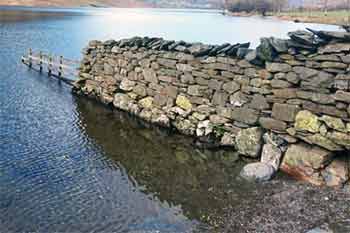
Site entry/exit: Entry into the water is shallow from the shingle, which quickly turns to large pebble rocks. These can be quite slippery but manageable. You have to walk some 5m out to get to water about 4ft deep. Then it drops off quite steeply to approx 5m deep. Note the bed from here is silt and easily disturbed so good buoyancy is a must. This picture was taken in the winter with a higher water level.


Underwater directions: Keep the bank to your left follow the contour of the lake for a couple of minutes and you drop over a rock face to a depth of about 11m. Continue to keep the bank on your left (and you'll swim in an arch around a small bay) approx 5 mins. You can see small trout, eels, perch and minnows in the shallow water.
At this point, you should have reached the shoulder of the main wall (on your left) approx 18m. The wall can be very spectacular on a sunny day.
Follow the wall down and swim for a further 5 mins by which time you will have descended to about 22m. Keep to this depth and watch for an orange line coming out from the wall at about 25m perpendicular to your direction of the swim. This is your guideline down a steep silty slope to a depth of 30m. At this point, without a good torch you are in pitch black (Crummock is a good testing ground for the Clyde).
The line then goes left and is about 6" off the lake bed and continues for another 10mins until you reach a depth of 33m. After this, there's no more line to follow, so if you have the gas and don't mind the extra deco, you can line off and explore the nothingness. Otherwise, it is about turn along the line, up the silt slope to 25m.
So now with the wall on your right side, you can either retrace your steps or ascend up the wall to about 15m and follow back round to small drop off 5mins from your entry point.
Air & Nitrox: No shops near here. Air from Clubs
Site Hazards: Cold and visibility also Lake Altitude 99 metres Care should be taken regarding routes leading away from Crummock water.
Nearest Public phone: None close to here.
Mobile Network service: Mobiles don't work here.
Accommodation: Buttermere YHA
Other comments: Permission should be obtained from the National Park Authority warden for this lake. Warden is Mark Astley.  (01900) 85267 Lake Altitude at 375 feet (99 metres). Care should be taken regarding routes leading away from this dive site.
Pub: In Lorton. or at Buttermere village.
Cafe: None near here so take everything you need (hot flask of soup)
Created by: John C
Date: 10/12/10
Revision: 1
Thanks To:
Links: Link
Surface Photos: By John C
Underwater Photos: Utube Contact me
Dive Map:

